For decades, meteorologists and climate scientists have adhered to conventional wisdom, attributing the birth of tornadoes and severe thunderstorms primarily to specific regional features—most notably, the Gulf of Mexico’s warmth and moisture, coupled with the rugged terrain east of the Rocky Mountains. While these ideas provided a foundation, they often lacked the empirical strength of modern scientific validation. Now, advances in climate modeling have shifted the paradigm, demonstrating that our understanding of storm genesis is far more intricate—and surprisingly malleable—than previously thought. At the forefront of this innovative approach is a recognition that Earth’s land surface properties and atmospheric interactions profoundly influence where and how severe storms form.
Instead of focusing solely on transient atmospheric conditions, current research emphasizes the importance of Earth’s physical features—such as surface roughness, land use, and topography—in shaping weather patterns. This shift instills a new perspective: the environment we shape through land management and climate change may be just as pivotal in determining storm behavior as the atmospheric ingredients themselves. This insight underscores the necessity for scientists and policymakers alike to consider the broader, often overlooked, physical context when analyzing and preparing for severe weather events.
The Power of Virtual Experiments in Understanding Storm Dynamics
The technological leap from traditional observation to sophisticated computer simulations has revolutionized meteorology. While storm chasers still track tornadoes across the plains, their methods are limited to immediate phenomena; they cannot manipulate the climate or physically reconfigure Earth’s surface. In contrast, climate scientists like Dan Chavas utilize virtual experiments—meticulously crafted digital worlds—to dissect the complex interplay of factors that give rise to severe weather.
By employing climate models that integrate extensive historical data, researchers can perform hypothetical scenarios that were impossible in the pre-digital era. Imagine, for example, “filling in” parts of the Gulf of Mexico with land or smoothing out the terrain of South America to match oceanic surfaces. These experiments reveal how specific variables—such as surface roughness or moisture availability—affect storm formation and intensity. Though these are virtual simulations, their implications shed light on real-world processes and potential future outcomes.
Chavas’ work exemplifies this paradigm, using these models as laboratories to test longstanding hypotheses—like whether the Gulf is truly as critical as once believed or whether the Amazon’s surface texture impacts storm activity. These experiments challenge assumptions, refine our understanding of storm physics, and open avenues for predicting how modifications to land and climate could alter severe weather risks.
Regional Differences Highlight the Role of Surface Features
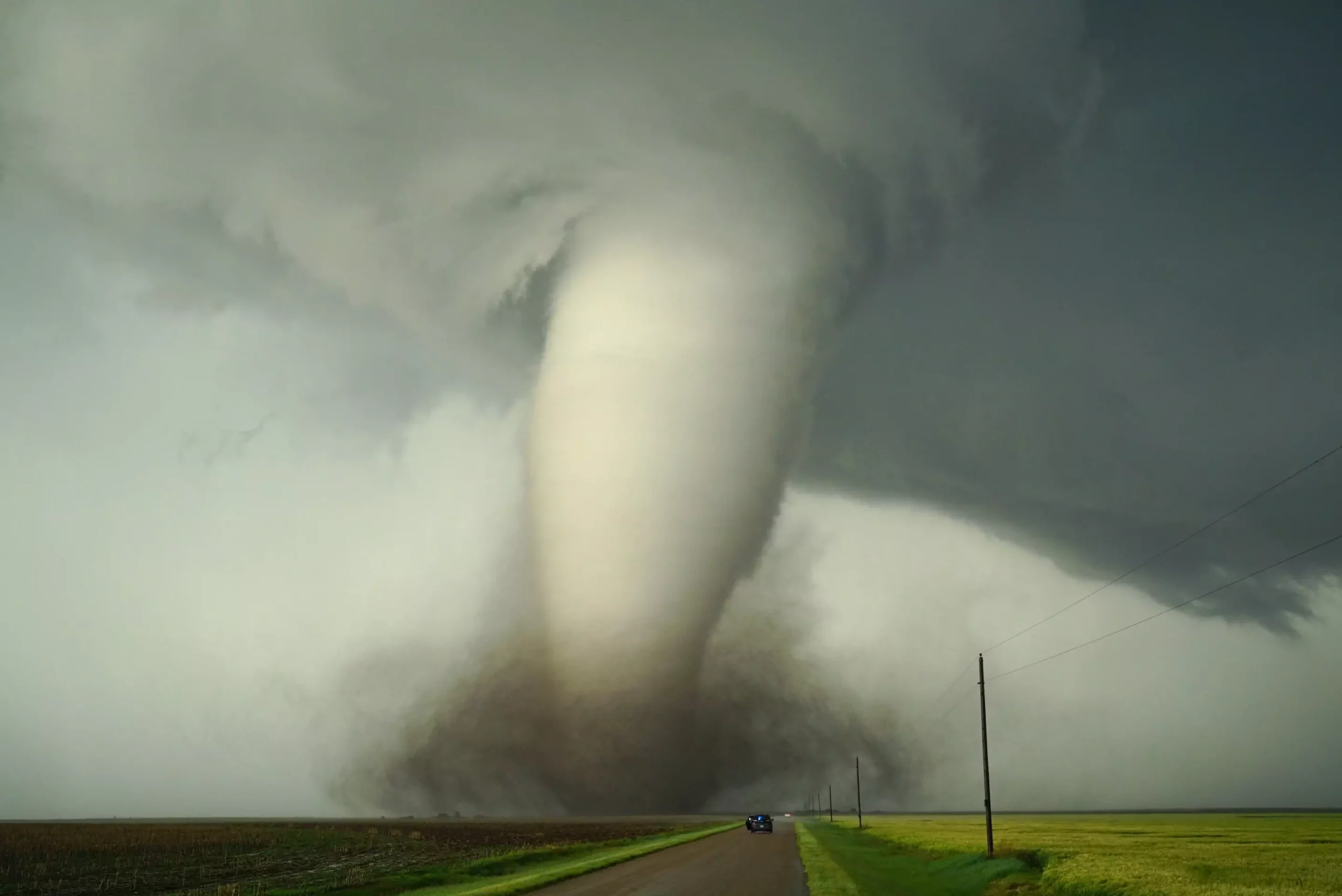
One of the most striking revelations from recent studies is how regional geography and land surface characteristics impact tornado frequency and severity. North America, with its high tornado incidence, has often been seen as the textbook example of storm-prone land. Meanwhile, South America’s analogous geography does not produce as many tornadoes, prompting scientists to look for differences beyond mere climate or moisture levels.
Research indicates that the roughness of land surfaces—such as forests, hills, and dense vegetation—has a substantial influence. The Amazon rainforest, with its intricate canopy and complex terrain, appears to act as a natural buffer, disrupting the wind shear necessary for tornado formation. Conversely, the relatively flat and smooth surface of the Gulf of Mexico enables stronger wind shear to develop in the atmosphere above the sea, fueling the genesis of destructive tornadoes.
Such findings highlight a critical, often underappreciated factor: surface roughness modifies wind patterns by affecting how faster winds change with height—a phenomenon known as wind shear. Since tornadoes depend heavily on wind shear, the physical texture of the Earth’s surface becomes a gatekeeper for storm potential. This perspective suggests that modifying land use—such as reforestation or deforestation—could influence local and regional storm behavior, opening provocative questions about our ability to indirectly control severe weather through environmental management.
Implications of Climate Change on Storm Patterns
The link between climate change and severe storms is complex and multifaceted. While rising global temperatures and drier conditions are well-known aspects, the subtler effects—such as shifts in atmospheric circulation and jet stream patterns—are less understood but arguably more impactful.
Chavas’ research emphasizes that changes in large-scale wind flow patterns can rearrange the ingredients necessary for tornado development. If the jet stream—and consequently the pathways of moist, warm air inland from the Gulf—alter due to climate change, the geographic distribution of tornadoes might also shift. Some regions may see an increase in storm activity, while others could experience a decline, entirely changing the landscape of weather risk.
Additionally, modifications in land cover—whether through urbanization, deforestation, or agricultural expansion—interact with climate trends to influence local wind shear and moisture patterns. The profound implication is that human intervention in land use does not merely shape ecosystems but can also serve as a lever—intentional or otherwise—in modulating severe weather. Recognizing these connections urges a more integrated approach to environmental policy, combining climate mitigation with land management strategies to better anticipate future storm behaviors.
From Theoretical Models to Practical Preparedness
The significance of research like Chavas’ extends beyond academic curiosity; it presses on practical considerations of disaster preparedness and climate resilience. Understanding that Earth’s physical features and land configuration can either foster or inhibit severe storms advances our capacity for prediction. Governments and communities can leverage this knowledge to design smarter urban planning, forestry policies, and land use strategies that mitigate risk.
Moreover, these insights highlight the importance of integrating climate science with meteorological forecasting. As the climate continues to evolve, the static assumptions of the past may no longer hold. Instead, flexible models that account for changing land surfaces and atmospheric patterns will become indispensable tools in safeguarding lives and property.
In an era where climate uncertainty hangs heavily over everyone, such scientific advancements provide a glimmer of agency. They suggest that the battle against nature’s most destructive phenomena might not only be waged through better prediction but also through conscious alteration of the environment—transforming landscapes in ways that diminish tornado potential and foster safer communities.