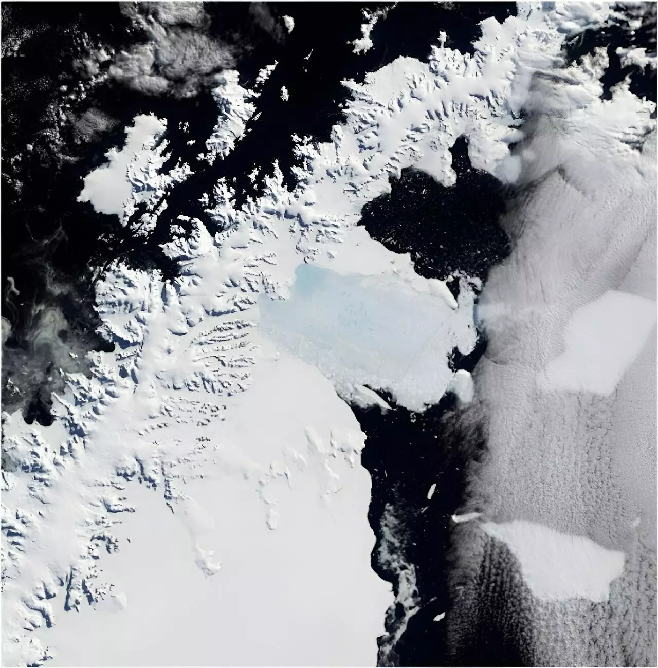
The astonishing and tragic collapse of the Larsen B Ice Shelf in March 2002 marked a pivotal moment in our understanding of climate change and its consequences. Spanning an area about one-sixth the size of Tasmania, this catastrophic event reshaped our planet’s topography and offered a haunting reminder of how climate shifts can unleash widespread environmental havoc. Recent research, published in *Scientific Reports*, utilizes a treasure trove of nearly 1,000 film photographs taken during the 1960s to explore the state of five critical glaciers preceding this ice shelf’s demise. This endeavor is not merely a historical exercise; it lays a robust groundwork for assessing the glaciers’ contributions to global sea-level rise.
Ice Shelves and Their Role
Ice shelves serve as nature’s regulatory agents, acting as thick, floating ramparts tethered to Antarctica’s coastline. While the melting of an ice shelf might not directly instigate sea-level rise, these structures play a crucial role in restraining the flow of the associated glaciers. When ice shelves fracture and break apart, the inevitable result is a surge in glacier flow into the ocean, which directly contributes to rising sea levels. The disconnect between the perceived isolation of Antarctica and the global repercussions of its ice loss can often drown out the alarm bells. As the world steadily warms, the collapse of these colossal ice formations threatens to unleash a cascade of glacial melt, challenging coastal cities and ecosystems worldwide.
The Challenges of Data Collection
Collecting definitive data from remote regions of Antarctica poses formidable challenges. The geographical remoteness, coupled with persistent cloud cover, has limited the long-term observational capacity needed to forecast changes accurately. Traditionally, researchers have relied on satellite imagery; however, its efficacy is often hampered by atmospheric conditions that obscure visibility. As a result, scientists are increasingly turning to historical archives to paint a more complete picture of glacial and environmental dynamics.
The *United States Navy*, from 1946 to 2000, meticulously documented the icy expanse with over 330,000 high-quality photographs, providing a rare glimpse of the landscape that modern science struggles to capture. The efforts of the *Polar Geospatial Center* at the University of Minnesota to digitize and share these images have unlocked an invaluable resource for researchers, allowing them to create accurate three-dimensional models of changes over time through advanced techniques like photogrammetry.
Photogrammetry: Reviving Lost Landscapes
This sophisticated method allows researchers to reconstruct the geography of polar environments with remarkable precision. By analyzing overlapping images, scientists can generate high-resolution, three-dimensional representations of glaciers that reflect their conditions before and after significant events, such as the collapse of the Larsen B Ice Shelf. This not only enhances our real-world understanding but also provides a stark visual contrast showing the glaciers in 1968 versus their state after the 2002 collapse, when they lost approximately 35 billion tons of ice.
This staggering 35 billion tons, while seemingly numerical and unobtrusive, equates to a considerable increment in global sea levels—illustrating how localized events can resonate across continents. The loss stems from one glacier alone, demonstrating the interconnectedness of environmental systems that can, in a heartbeat, ripple through global populations and ecosystems.
Beyond the Ice: Future Implications and Applications
As our climate continues to evolve at an alarming rate, the implications of this research transcend the icy borders of Antarctica. The mounting threat to the remaining ice shelves highlights the need for a more profound understanding of glacier dynamics, which can inform predictive models of future sea-level rise. Furthermore, the historical image archive opens doors to a plethora of interdisciplinary studies. Researchers can utilize these images to explore not only the retreat of ice but also coastal changes, biodiversity impacts, and the manifestations of climate change beyond the confines of glaciology.
For instance, the same photographs can illuminate transformations within penguin populations, the encroachment of vegetation in once-frigid areas, or even the direct impacts of human activity. Each of these insights is critical for forming a holistic understanding of our planet’s rapid evolution.
The Call for Urgent Action
As we continue to grapple with the ramifications of climate change, our collective responsibility to advocate for urgency in addressing these shifts becomes paramount. The research on the Larsen B Ice Shelf serves as a clarion call to understand the past vigor of glaciers and ice shelves and to grasp the potential of human action—or inaction—in shaping the future. The images captured decades ago may very well dictate the urgency of our response today, converging the past and present into a singular point of scientific and moral reckoning.