Natural disasters like wildfires present significant dangers, not only to the surrounding ecosystems but also to the brave individuals tasked with extinguishing them. In the harrowing event of a fire breaking containment lines, firefighters must swiftly navigate their escape routes with a keen sense of urgency. Historically, the reliance on instinct and limited technological aids has posed severe threats to their safety. However, a groundbreaking new model developed by researchers at the University of Utah promises to change this landscape dramatically.
Firefighters often find themselves racing against time when faced with unpredictable wildfire behavior. The critical question is: what are the best escape routes, and how long will they take? The conventional tools at their disposal, while beneficial in certain contexts, tend to overly simplify the complexities of real terrain, focusing primarily on slope steepness. While this factor is undoubtedly crucial, it does not account for other variables that can significantly affect travel time, such as ground roughness and vegetation density. For instance, traversing a steep, paved road may offer quicker egress than maneuvering through flat, uneven boulder fields or dense shrubbery.
Real-world experiences indicate that firefighters often rely heavily on their expertise and the terrain’s visual cues to make these life-or-death decisions. This reliance on anecdotal evidence introduces an element of uncertainty when evaluating the best escape paths. Furthermore, the absence of robust data-based modeling confines their decisions to reactive strategies rather than proactive planning, an approach that can have tragic consequences in life-threatening situations.
Enter Simulating Travel Rates in Diverse Environments (STRIDE), the innovative model that aims to transform escape strategies for firefighters and outdoor professionals alike. In their recent publication in *Scientific Reports*, the researchers unveiled STRIDE as the first sophisticated model that assesses multiple terrain features—ground roughness, vegetation density, and slope steepness—to predict travel times with unparalleled precision.
Lead author Mickey Campbell, a research assistant professor at the School of Environment, Society, and Sustainability at the University of Utah, emphasizes that understanding mobility is a matter of survival in emergencies. The STRIDE model was meticulously designed to provide accurate, efficient navigation choices, potentially saving lives in critical situations where time is of the essence.
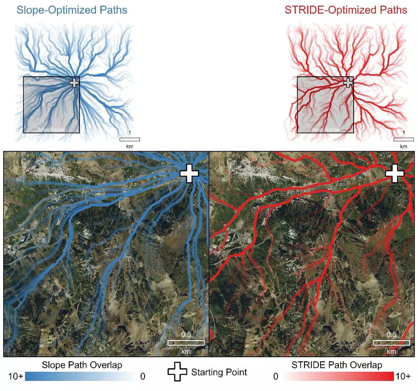
Through extensive field experiments and analysis of airborne LiDAR data, the research team was able to create an equation that identifies optimal routes in various terrains, ranging from urban environments to rugged forests. The results not only corroborated the model’s efficacy but also displayed a preference for paths that aligned with human instinct—favoring trails, roads, and areas of least resistance. In stark contrast, traditional models that focus solely on slope data often projected underestimated travel times, a misguided assumption that could have deadly implications for responders.
The research methodologies employed by the team were critical in establishing STRIDE’s trustworthiness. By conducting extensive field trials with volunteers traversing diverse 100-meter transects, researchers were able to gather empirical data that reflected a variety of conditions. These trials not only tested the model’s effectiveness but also yielded insights into human performance across different environments, a feat that was relatively uncharted in previous studies.
The trials spanned various landscapes—one being the steep slopes and dense vegetation of the Wasatch Mountains, while another examined urban settings to determine STRIDE’s adaptability across instances. In each scenario, STRIDE emerged as a superior option that not only accounted for the terrain’s complexity but also mirrored the rationale behind human navigation choices more accurately than traditional methods.
Real-World Applications and Future Implications
The impact of STRIDE extends beyond just improving firefighter safety; this model has far-reaching implications across various fields, including disaster response, healthcare logistics, defense strategies, and even outdoor recreational planning. The researchers have made the STRIDE model publicly available, empowering practitioners and enthusiasts alike to enhance their landscape navigation based on rigorous data rather than mere intuition.
As Campbell keenly points out, the relevance of this research manifests not only from an academic standpoint but also from its potential real-world applications. The model’s immediate accessibility allows for an array of stakeholders—from emergency responders to urban planners—to utilize STRIDE for more informed decision-making in crisis situations.
The introduction of STRIDE marks a monumental leap forward in navigating the often treacherous landscapes encountered during wildfires. By integrating various crucial terrain factors into a cohesive model, STRIDE equips firefighters and other professionals with essential tools for effective, timely evacuations. As we continue to grapple with the increasing frequency and intensity of wildfires, innovations like STRIDE remind us of the critical intersection between technology and human safety on the front lines.

